Skip to content Arab Nubia Group Blog – Page 6 – GIS, Remote Sensing & General Applications
  • Website
  • Facebook
  • YouTube
  • LinkedIn
Arab Nubia Group Blog

Arab Nubia Group Blog

GIS, Remote Sensing & General Applications

  • Home
  • General
  • GIS
  • Remote Sensing
  • Contacts

Featured

  • Download Sentinel-2 PCA mosaic for Arabian Shield Exposure in Saudi Arabia
  • Arab Nubia Group Announces Mega Remote Sensing Project for the Arabian Nubian Shield
  • Vertical accuracy assessment of the Copernicus DEM for EGYPT
  • Amazing database for most of remote sensing indices in one place
From the Blog
1 Dec8 Oct

Google Timelapse

1 Sep8 Oct

GeoTag Photos to Geographic Location

15 Jul7 Oct

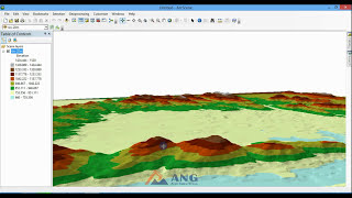
3D Surface Geology of Jebel-Gerf South Eastern Desert of Egypt

7 Jul8 Oct

Maadi Animated map

27 May8 Oct

ESRI Online Training

17 Apr8 Oct

Download Open Street Map in vector format

25 Feb8 Oct

Modern Mining

22 Dec8 Oct

USGS Global interactive map from Mineral Resources

6 Dec8 Oct

Download SRTM v3 Index

18 Nov8 Oct

Digitizing old contour maps using Global Mapper

24 Sep8 Oct

Sukari gold mine activity past 10 years

25 Aug2 May

GIS Training

22 Jun14 Oct

Aster DEM Processing a Water body fill

4 Apr8 Oct

Land Survey of Limestone Quarry

18 Feb8 Oct

Design quick open pit on global mapper

1 Jan8 Oct

HOW TO DEAL WITH ASTER DEM IN ARCGIS

27 Nov8 Oct

Band Combination & Pan Sharpening imagery in ArcMap

17 Nov8 Oct

Lesson3: online BaseMaps in ArcGIS

10 Nov8 Oct

Lesson2: Coordinate systems and Map Projections

4 Nov8 Oct

Lesson1: What is GIS

Posts pagination

Previous 1 … 4 5 6

User Panel

  • Log in
  • Dashboard
  • Register
  • Log out

Recent Posts

  • Download Sentinel-2 PCA mosaic for Arabian Shield Exposure in Saudi Arabia
  • Arab Nubia Group Announces Mega Remote Sensing Project for the Arabian Nubian Shield
  • Vertical accuracy assessment of the Copernicus DEM for EGYPT
  • Download Egypt shapefile for geographic feature names
  • Amazing database for most of remote sensing indices in one place
  • Download Sentinel-2 Band Ratios PCA mosaic for Central Eastern Desert of Egypt
  • Download 10-meter Sentinel-2 mosaic for Eastern Desert of Egypt (June 2021)
  • Download Sentinel-2 mosaic of Egypt (Cloudless-June 2021)
  • Download Drainage Analysis Shapefile Dataset for Eastern Desert of Egypt
  • Egypt Copernicus Digital Elevation model (1 Arc-Second)

Archives

Categories

  • General
  • GIS
  • Remote Sensing

Calendar

April 2026
S M T W T F S
 1234
567891011
12131415161718
19202122232425
2627282930  
« Jan    

Tags

africa (1) Algeria (2) arabian nubian shield (3) basins (1) Copernicus DEM (1) Digital Elevation Model (23) Digitizing (1) Documentary (1) drainage analysis (4) egypt (13) esa (22) events (3) exploration (6) geology (13) gis (7) global_mapper (23) gold (6) google_earth (3) gps (1) graphics animation (3) hydrology (1) imagery (11) InSar (2) iraq (1) landsat (3) landuse (2) minerals (1) mining (4) Morocco (1) nasa (11) optical (1) radar (3) Remote Sensing (31) saudi arabia (3) sentinel (18) snap (9) spectral (5) stream order (1) Tunisia (3) tutorials (14) watershed (1)

Categories

  • General (30)
  • GIS (40)
  • Remote Sensing (54)

Social

  • Website
  • Facebook
  • YouTube
  • LinkedIn

Latest Articles

  • Download Sentinel-2 PCA mosaic for Arabian Shield Exposure in Saudi Arabia
  • Arab Nubia Group Announces Mega Remote Sensing Project for the Arabian Nubian Shield
  • Vertical accuracy assessment of the Copernicus DEM for EGYPT
Theme Designed by InkHive. © 2023 Arab Nubia Group Blog. All Rights Reserved.