Skip to content GIS – Arab Nubia Group Blog
  • Website
  • Facebook
  • YouTube
  • LinkedIn
Arab Nubia Group Blog

Arab Nubia Group Blog

GIS, Remote Sensing & General Applications

  • Home
  • General
  • GIS
  • Remote Sensing
  • Contacts

Featured

  • Vertical accuracy assessment of the Copernicus DEM for EGYPT
  • Amazing database for most of remote sensing indices in one place
  • Download Sentinel-2 Band Ratios PCA mosaic for Central Eastern Desert of Egypt
  • Download 10-meter Sentinel-2 mosaic for Eastern Desert of Egypt (June 2021)

Category: GIS

24 Mar24 Mar

Download Egypt shapefile for geographic feature names

8 May8 May

Download Drainage Analysis Shapefile Dataset for Eastern Desert of Egypt

1 May

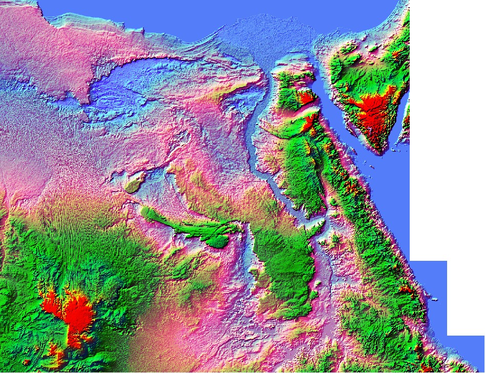
Egypt NASADEM Digital Elevation model 1 Arc-Second

9 Dec

Digitizing, symbols & Laying out geology paper map to digital map

14 Oct9 Dec

Tut12: Layout map in Global Mapper

10 Oct4 May

Africa Drainage Analysis Map

11 Sep8 May

Drainage Analysis Network Map for North & Middle Eastern Desert of Egypt

13 Jun15 May

Generate 3D contour layer from online SRTM

9 Jun15 May

3D Shapfile Contour layer of Egypt

Textured Landsat imagery
2 Jun15 May

Textured Landsat imagery with hillshade derived from DEM.

25 Jan15 May

Tut11: Extrude 3D Buildings using Global Mapper

11 Jan7 Oct

Tut10: Calculate NDVI & NDWI from sentinel 2 using Global Mapper

4 Jan14 Oct

Global Mapper Mobile App

16 Dec7 Oct

Tut9: Download Open Street Map(OSM) as vector using Global Mapper

3 Dec7 Oct

Tut8: Simulate River water flooding using Global Mapper

1 Dec7 Oct

Simulation of Nile Flooding at Cairo City

23 Nov7 Oct

Tut7: Calculate Pile Volume & Volumes Between Surfaces Using Global Mapper

9 Nov7 Oct

Explore 360° images in Google Earth

4 Nov7 Oct

GeoTag Photos to use on Google Earth

15 Oct7 Oct

Tut6: Create Voronoi diagram using Global Mapper

Posts pagination

1 2 Next

User Panel

  • Log in
  • Dashboard
  • Register
  • Log out

Recent Posts

  • Vertical accuracy assessment of the Copernicus DEM for EGYPT
  • Download Egypt shapefile for geographic feature names
  • Amazing database for most of remote sensing indices in one place
  • Download Sentinel-2 Band Ratios PCA mosaic for Central Eastern Desert of Egypt
  • Download 10-meter Sentinel-2 mosaic for Eastern Desert of Egypt (June 2021)
  • Download Sentinel-2 mosaic of Egypt (Cloudless-June 2021)
  • Download Drainage Analysis Shapefile Dataset for Eastern Desert of Egypt
  • Egypt Copernicus Digital Elevation model (1 Arc-Second)
  • Copernicus DEM30 meter available now for free
  • Introduction To Micromine 2021

Archives

Categories

  • General
  • GIS
  • Remote Sensing

Calendar

October 2025
S M T W T F S
 1234
567891011
12131415161718
19202122232425
262728293031  
« Apr    

Tags

africa (1) Algeria (2) arabian nubian shield (1) basins (1) Digital Elevation Model (22) Digitizing (1) Documentary (1) drainage analysis (4) egypt (12) esa (20) events (3) exploration (5) geology (11) gis (7) global_mapper (23) gold (5) google_earth (3) gps (1) graphics animation (3) hydrology (1) imagery (10) InSar (2) iraq (1) landsat (3) landuse (2) mining (3) Morocco (1) nasa (11) optical (1) radar (3) Remote Sensing (29) saudi arabia (1) sentinel (16) snap (8) spectral (5) stream order (1) Tunisia (3) tutorials (14) watershed (1)

Categories

  • General (29)
  • GIS (40)
  • Remote Sensing (52)

Social

  • Website
  • Facebook
  • YouTube
  • LinkedIn

Latest Articles

  • Vertical accuracy assessment of the Copernicus DEM for EGYPT
  • Download Egypt shapefile for geographic feature names
  • Amazing database for most of remote sensing indices in one place
Theme Designed by InkHive. © 2023 Arab Nubia Group Blog. All Rights Reserved.