Skip to content
egypt – Arab Nubia Group Blog
Website
Facebook
YouTube
LinkedIn
Arab Nubia Group Blog
GIS, Remote Sensing & General Applications
Home
General
GIS
Remote Sensing
Contacts
Featured
Vertical accuracy assessment of the Copernicus DEM for EGYPT
Amazing database for most of remote sensing indices in one place
Download Sentinel-2 Band Ratios PCA mosaic for Central Eastern Desert of Egypt
Download 10-meter Sentinel-2 mosaic for Eastern Desert of Egypt (June 2021)
Tag:
egypt
25 Apr
25 Apr
Vertical accuracy assessment of the Copernicus DEM for EGYPT
24 Mar
24 Mar
Download Egypt shapefile for geographic feature names
10 Aug
10 Aug
Download Sentinel-2 Band Ratios PCA mosaic for Central Eastern Desert of Egypt
5 Aug
5 Aug
Download 10-meter Sentinel-2 mosaic for Eastern Desert of Egypt (June 2021)
4 Aug
4 Aug
Download Sentinel-2 mosaic of Egypt (Cloudless-June 2021)
8 May
8 May
Download Drainage Analysis Shapefile Dataset for Eastern Desert of Egypt
5 May
5 May
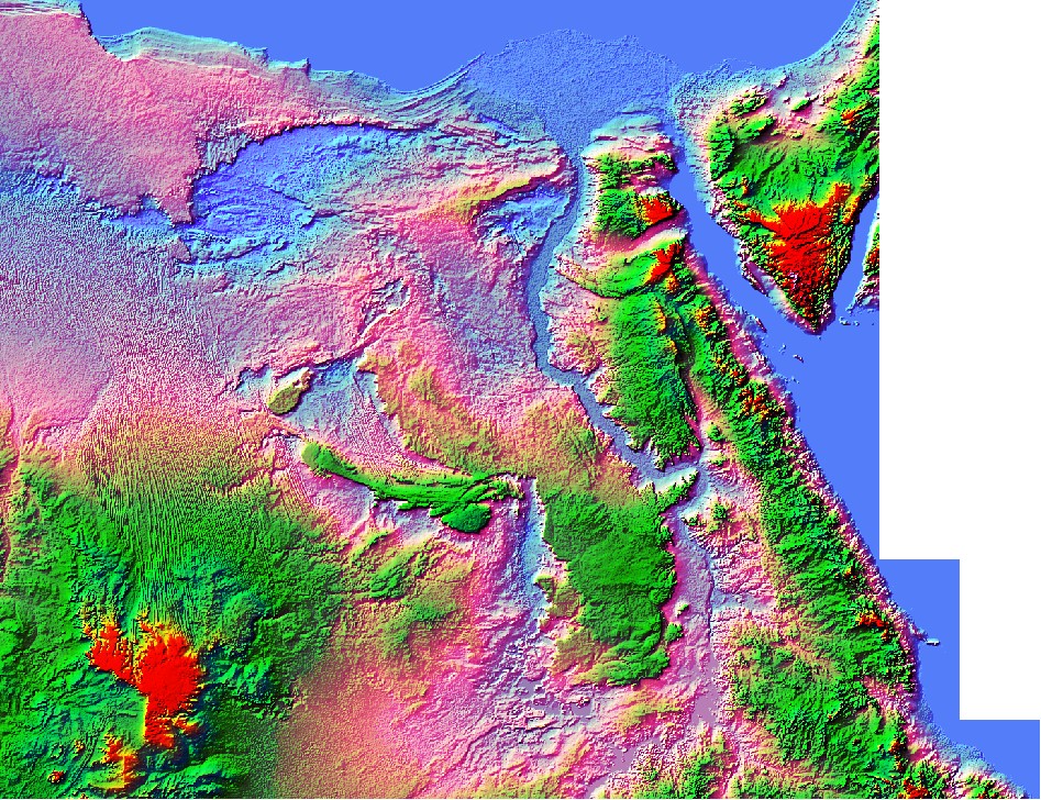
Egypt Copernicus Digital Elevation model (1 Arc-Second)
17 Jun
17 Jun
Sentinel-1 mosaic for North & Middle Eastern Desert of Egypt
1 May
Egypt NASADEM Digital Elevation model 1 Arc-Second
9 Apr
Documentary – Land Of Gold – EP01 Arabian Nubian Shield
9 Mar
25 Apr
Egypt Eastern Desert Basement Complex on Sentinel 2 PCA Mosaic
9 Jun
15 May
3D Shapfile Contour layer of Egypt